The Island America Forgot to Notice: How a 1970s Shipwreck Put a Missing Landmass on the Map
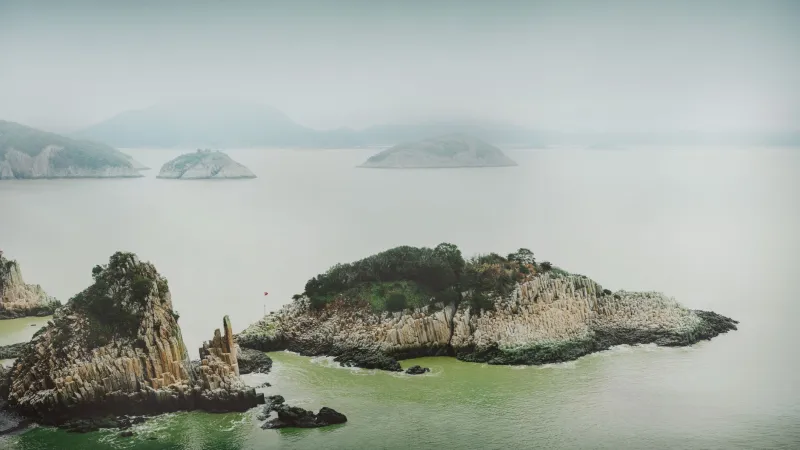
It seems like the kind of thing that couldn't happen. Not in the modern United States. Not in an era of satellites and survey planes and federal agencies specifically tasked with knowing exactly what's out there. And yet, for a meaningful stretch of the twentieth century, there was a piece of American land — an actual island, above water, in US territorial waters — that existed in a kind of official limbo. The government didn't map it. Didn't name it. Didn't formally acknowledge it existed at all.
It took a boat going down in the wrong place at the wrong time to change that.
The Waters Nobody Looked At Closely
The island in question sits in a stretch of coastal water that was, for most of American history, considered too shallow and too inconvenient to be worth careful attention. It wasn't on shipping lanes. It wasn't near a port. It didn't have fresh water or timber or anything else that would have made early surveyors particularly eager to document it. It was, in the language of people who chart coastlines, "not strategically interesting."
Early nautical charts of the region noted the general area as hazardous — shallow, rocky, not recommended for navigation — but the specific landmass wasn't drawn in. Whether it was too small to register from the survey vessels of the era, or simply overlooked in the rush to chart more commercially important waters, the result was the same: the island never made it onto any official federal document.
State-level records were equally blank. Local fishermen knew it was there, in the casual way that people who work a coastline know the shape of every rock and sandbar. But knowing something exists and having it formally recognized by the government are very different things.
For the island, that gap lasted well into the twentieth century.
The Wreck That Asked an Inconvenient Question
In the mid-1970s, a commercial fishing vessel ran aground in the area during a storm. The crew was rescued — that part of the story ended well. But the wreck itself, sitting in shallow water near an unmarked landmass, immediately created a bureaucratic problem that nobody had anticipated.
When the Coast Guard and the relevant salvage authorities tried to establish jurisdiction over the wreck, they ran into a wall. Jurisdiction in US coastal waters is determined by location. Location, in turn, requires accurate charts. The charts for this particular stretch of water showed open water. The reality showed an island.
The question of whose responsibility the wreck was — and, more pointedly, whose legal authority governed the waters around it — couldn't be answered without first answering a more fundamental question: what exactly was that piece of land, and why wasn't it on any map?
The Survey That Should Have Happened Decades Earlier
The National Oceanic and Atmospheric Administration was brought in to conduct an emergency survey of the area. What they found was embarrassing in the quiet, bureaucratic way that these things tend to be embarrassing: a legitimate island, measurable and mappable, that had simply never been formally documented by the federal government.
It wasn't tiny. It wasn't a sandbar that appeared and disappeared with the tide. It was a stable, fixed landmass — the kind of thing that, under normal circumstances, would have been charted, named, and incorporated into official records generations earlier.
The survey team did their work. The island got a name — a functional, descriptive one assigned by NOAA rather than anything with historical resonance. It was added to the official nautical charts. The wreck's jurisdiction was resolved. And a small but genuine gap in America's geographic self-knowledge was finally closed.
The Ripple Effects Nobody Expected
Here's where the story gets interesting beyond the basic strangeness of an unmapped island. Because once the island was officially recognized, a chain of legal and administrative consequences kicked in that the relevant agencies hadn't fully prepared for.
Under maritime law, the formal recognition of a landmass in territorial waters can affect baseline calculations — the lines from which a country's territorial sea, contiguous zone, and exclusive economic zone are measured. In practical terms, officially acknowledging the island shifted, slightly but meaningfully, the outer boundary of the zone in which the United States had exclusive rights to fish, to extract resources, and to regulate foreign vessels.
It was a small shift. The island wasn't large enough to dramatically redraw anyone's maps. But in the precise, coordinates-based world of maritime law, even small shifts matter. Fishing rights that had previously existed in a gray area were suddenly clarified. A stretch of water that had technically been in dispute — not publicly, but in the fine print of international maritime agreements — was formally absorbed into US jurisdiction.
All of it triggered by a boat that went down in a storm.
The Fishermen Already Knew
Perhaps the most telling detail in the whole episode is this: when federal surveyors arrived to formally chart the island, local fishermen were not surprised to see them. They knew the island. They had names for it — informal ones, passed down through generations of people who worked those waters. They had been navigating around it for decades.
The knowledge existed. It just existed outside the systems that official America uses to acknowledge reality.
That's not as unusual as it sounds. The history of American geography is full of places that communities knew intimately long before any federal agency got around to writing them down. What makes this particular case remarkable is how the gap was finally forced shut — not by a planned survey or a policy review, but by a shipwreck that made ignoring the oversight legally impossible.
Sometimes it takes a disaster to make the government look at what was always right there in front of it.